News tagged remotesensing
-
Eagleview, Skywatch Launch High-Res Single Image Aerials
Eagleview, a leading provider of aerial imagery and analytics, and SkyWatch, a leader in remote sensing data technology, today are announcing a new collaboration that makes Eagleview’s ultra high-resolution aerial imagery available across the SkyWatch platform. This new initiative is a response to the growing requests of customers in architecture, engineering, construction, and other industries who […] <p>The post Eagleview, Skywatch Launch High-Res Single Image Aerials first appeared on CCR-Mag.com.</p>
-
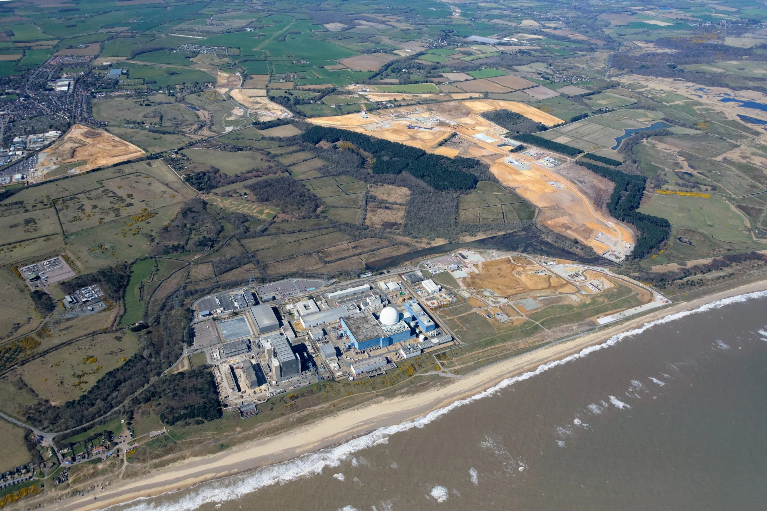
Framatome awarded backup power and remote sensing Sizewell C contract
Framatome has been awarded a contract to provide conventional field instrumentation (CFI) and emergency backup power generation capacity to Sizewell C. The post Framatome awarded backup power and remote sensing Sizewell C contract appeared first on New Civil Engineer.
-
Biodiversity impact from Ukraine’s Kakhovka dam breach assessed remotely
The impact on biodiversity in southern Ukraine following the breach of the Nova Kokhovka dam has been studied in an “unprecedented” rapid assessment by the UK Centre for Ecology and Hydrology (UKCEH) and HR Wallingford using remote sensing. The post Biodiversity impact from Ukraine’s Kakhovka dam breach assessed remotely appeared first on New Civil Engineer.
-

The global fixed wing drone market is estimated at US$ 7,085.1 million in 2023 and is expected to expand at a healthy 17.2% CAGR during the forecast years of 2023-2033. Aerial remote sensing products for critical infrastructure such as military bases, government buildings, airports and banks are the key market drivers for growth. Fixed-wing drones […] The post <strong>Increasing Deployment to Carry Out Aerial Remote Sensing Increasing Fleet of Fixed Wing Drone, States Fact.MR</strong> appeared first on Civil + Structural Engineer magazine.
-

Helisul partners with FIXAR to meet Brazil’s booming BVLOS drone demand
Deployment of drones in Brazil for both business and pleasure is on the rise. But demand is especially strong from Brazilian enterprise users operating long-range, beyond visual line of sight (BVLOS) surveying, remote sensing, and surveillance missions. To meet those pressing needs, local aviation group Helisul Aviação is partnering with innovative European drone and software […] The post <strong>Helisul partners with FIXAR to meet Brazil</strong>’<strong>s booming BVLOS drone demand</strong> appeared first on Civil + Structural Engineer magazine.
Posts tagged remotesensing
Get full access to our construction knowledge base, latest news and updates ... Join the discussion.