Resources tagged photography-and-drone-monitoring
-
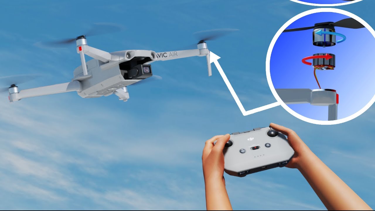
Drones | The complete flight dynamics
Let's learn the complete flight dynamics of the drones in this video.
Posts tagged photography-and-drone-monitoring
Businesses tagged photography-and-drone-monitoring
-
Chartered Surveyor with 40 years experience with particular interest and expertise in land and boundary issues, neighbour disputes. We provide opinion, reports and testimony on land boundaries, easements, rights of way for solicitors, barristers and court. We also provide forensic mapping services in respect of land Title issues and mapping for boundary rectification and property registration. Other services include "Realtime" Measured building surveys, Land mapping and surveying, GIS data collection, 3d modelling and visualisation using terrestrial photogrammetry and ortho rectification. We also provide a full range of UAV mapping, modelling and inspection services including thermal imagery.
-

Drone Tech Aerospace Ltd (DTA)
DTA focuses on the complex engineering sector of the aerial surveying market where our extensive engineering background gives us the edge. Aerial surveying excellence in : * Safety * Piloting * Software * Engineering * Drone Technology
-

"Established in 2004, Photodrones is the UK’s original Aerial Imaging Company. With unrivalled experience, technical knowledge and safety record, Photodrones holds unique and privileged permissions to fly in congested areas and cities worldwide, including the USA. Best High Resolution Drone photography & videography for your personal or commercial projects in Bristol & Cornwall, London. Email us at [email protected] or Call 07836585284 Photo Drones today!
-

TrueView Drone Services are a UK based commercial drone services company providing Unmanned Aerial Vehicle services across the built environment ranging from topographical survey data, stockpile measurements, building surveying and inspections including 3D modelling, thermal imaging data, 2D mapping for site progress as well as photography and videography. We are photogrammetry specialists and with our top of the range drone fleet we can quickly and safely gather accurate survey grade data, ultimately saving money in the process, and process it to get the accurate results required. We work across the UK and Ireland with main contractors, subcontractors, consultants, developers and local authorities.
Get full access to our construction knowledge base, latest news and updates ... Join the discussion.