News tagged mapping
-

North Sea geology more complex for undersea infrastructure than assumed, BGS says
New research mapping the upper 2m of seabed across the UK North Sea suggests the ground into which subsea power and telecommunications cables are buried is far more geologically varied than was previously thought. The post North Sea geology more complex for undersea infrastructure than assumed, BGS says appeared first on New Civil Engineer.
-

Mark Reynolds: Putting skills on the map
As chair of the Construction Skills Mission Board, Mark Reynolds is mapping out the complex network of projects and training The post Mark Reynolds: Putting skills on the map appeared first on Construction News.
-
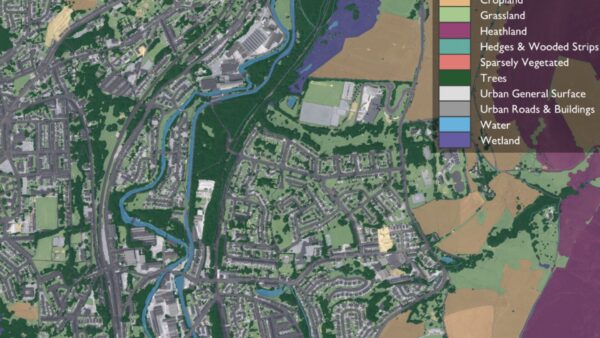
OS mapping tool shows exactly what’s on the land to ease BNG planning
The tool shows what’s on a plot of land to help developers plan their BNG commitments more easily. The post OS mapping tool shows exactly what’s on the land to ease BNG planning appeared first on Construction Management.
-
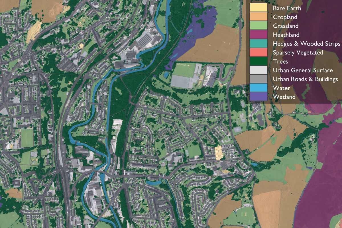
Ordnance Survey has created a new tool to map habitats, supporting developers in reaching targets for a 10% uplift in biodiversity.
-
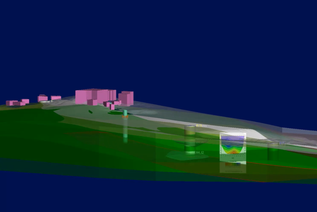
Ayesa advances 3D ground modelling to power the next generation of tunnelling
Ayesa head of ground engineering and tunnelling Cláudio Cabral Dias warns that while subsurface 3D mapping is increasingly vital for successful projects, changing how industry works requires companies to plan for retraining their people. The post Ayesa advances 3D ground modelling to power the next generation of tunnelling appeared first on New Civil Engineer.
Resources tagged mapping
-
OpenSpace - OpenSpace Site Capture Technology Overview 19042022
OpenSpace provide an automated 360° video job site capture and mapping and they offer a fast, simple and advanced tool. Watch this brief video for a high-level look at their technology and then be inspired to learn more or contact them
-

FMi - How Bumpy is it going to get, Mapping Recession Scenarios, July 2022
FMi provide the economic outlook for Engineering & COnstruction firms within the U.S.
-
Tom Scott - The Concrete Pillars On Top Of British Hills: Trig Points, 08122014
Around the United Kingdom there are odd concrete pillars on the top of hills, built to last for decades if not centuries. They've got a cryptic marking on them, and the words "Ordnance Survey Triangulation Station". What are they? (They're trig points.) Who put them there? (Brigadier Martin Hotine and thousands of people working with him.) And why? (To get an accurate map of the UK, with maths.)
Get full access to our construction knowledge base, latest news and updates ... Join the discussion.