News tagged esri
-

Esri and Pix4D launch reality capture workflow
Integration enables users to document subsurface assets with ‘seamless precision’. The post Esri and Pix4D launch reality capture workflow appeared first on AEC Magazine.
-
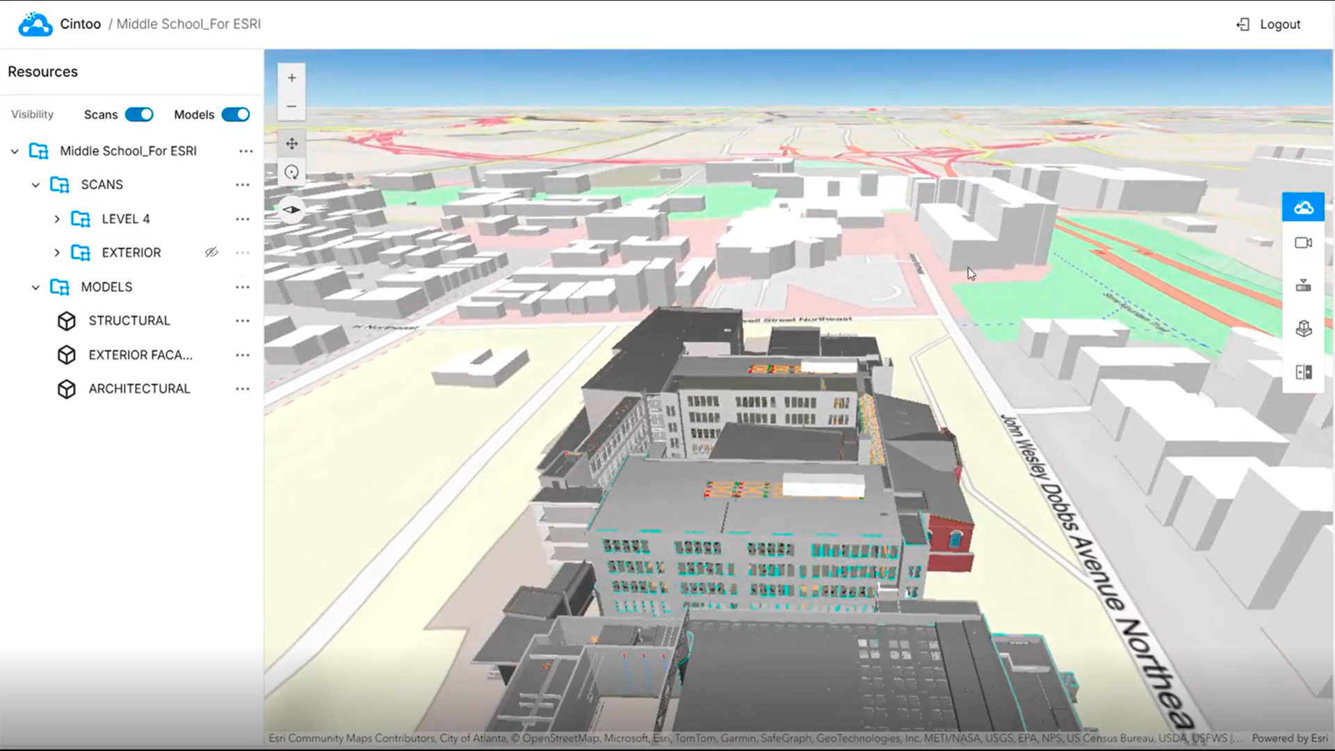
Cintoo launches ArcGIS integration
Esri Experience Builder Widget for ArcGIS brings high-fidelity 3D scan data to into GIS environment The post Cintoo launches ArcGIS integration appeared first on AEC Magazine.
-

Esri Bringing Gaussian Splats, More AI Into Its ArcGIS Mapping Tools
Esri announced new AI tools based on its partnership with Microsoft, Gaussian splats in its ArcGIS platform and more extended reality tools at its 45th user conference.
-
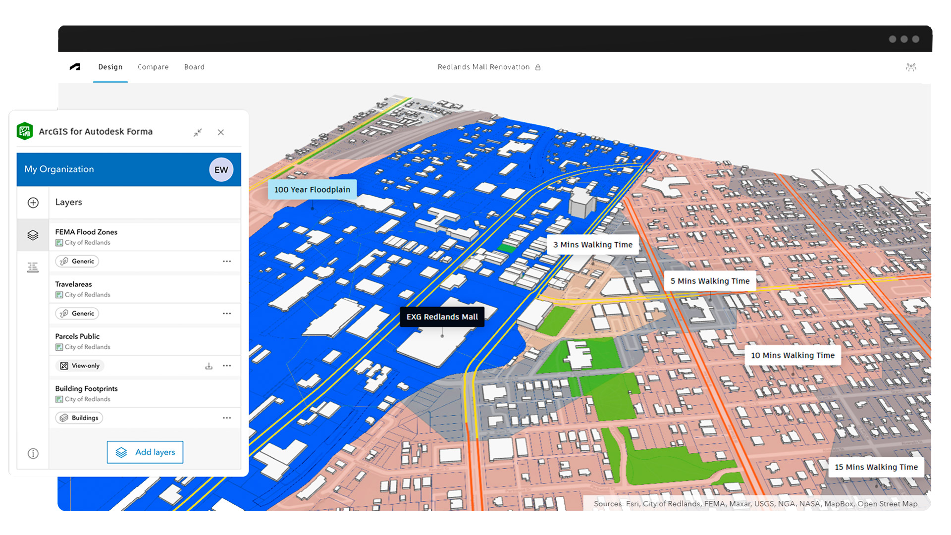
Esri launches ArcGIS for Autodesk Forma
New integration makes GIS data directly accessible in concept design phase The post Esri launches ArcGIS for Autodesk Forma appeared first on AEC Magazine.
-

Autodesk Advances Esri Partnership, Further Explains Data Strategy
Autodesk reiterated its commitment to artificial intelligence-enhanced workflows for architects, engineers and construction professionals and introduced a new data exchange with Esri at its annual Autodesk University user conference in San Diego.
Get full access to our construction knowledge base, latest news and updates ... Join the discussion.