News tagged aerialmapping
-

Bluesky Geospatial Launches MetroVista 3D Aerial Mapping Program in U.S.
Bluesky Geospatial Ltd. has announced the launch of its MetroVista 3D aerial mapping program in the United States. The service employs a hybrid imaging-LiDAR airborne sensor to capture highly detailed 3D data, including 360-degree views of buildings and street-level features, in urban areas for use in creating digital twins, visualizations, and simulations. Bluesky’s sister company, […] The post <strong>Bluesky Geospatial Launches MetroVista 3D Aerial Mapping Program in U.S.</strong> appeared first on Civil + Structural Engineer magazine.
-

Position Partners launches 3-in-1 mapping tool
Position Partners has announced the launch of SmartSurveyor, a compact device that can be used for survey-grade aerial mapping projects … The post Position Partners launches 3-in-1 mapping tool appeared first on Inside Construction.
-

Phase One Announces Next-Generation Aerial Solutions Enhanced with Near Infrared Capabilities
COPENHAGEN, – Phase One, a leading developer of digital imaging technologies, today announced its next-generation aerial mapping solutions. The Phase One PAS 880 oblique and PAS 280 nadir systems have been enhanced with 150MP near-infrared (NIR) sensors and the most productive workflow with the launch of the latest iX Suite SW solution. The new PAS 880i […] The post Phase One Announces Next-Generation Aerial Solutions Enhanced with Near Infrared Capabilities appeared first on Civil + Structural Engineer magazine.
-
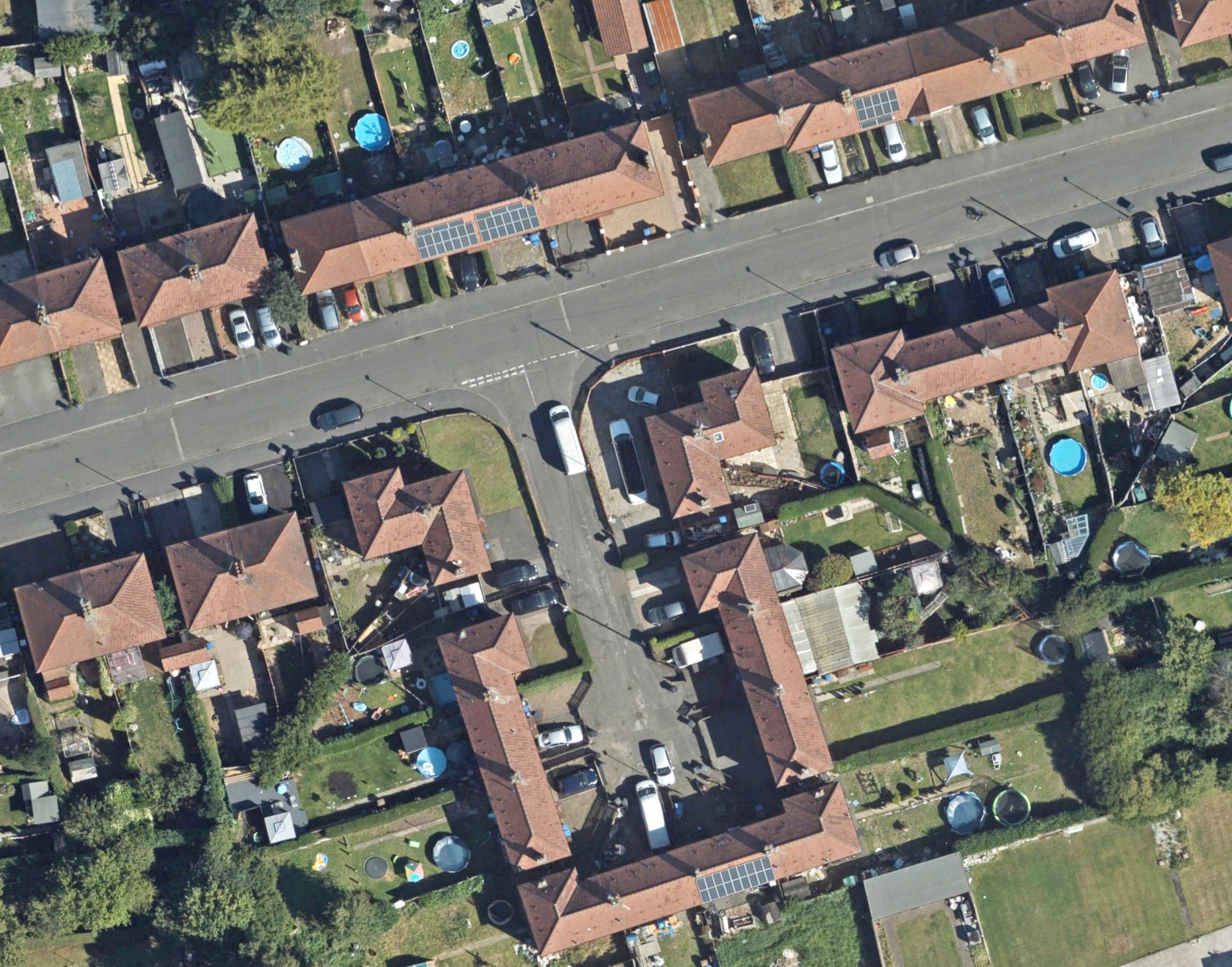
Aerial mapping the way to greener homes
Aerial mapping reveals the potential of roof spaces to mitigate the effects of climate change. The post Aerial mapping the way to greener homes appeared first on Planning, BIM & Construction Today.
-

Halff Associates, Inc. Completes Acquisition of Morrison-Shipley Engineers
RICHARDSON, Texas and FORT SMITH, Arkansas — Halff Associates, Inc. (Halff) has announced the completion of its acquisition of Morrison-Shipley Engineers. This strengthens Halff’s position as one of the nation’s leading engineering/architecture consulting firms. Morrison-Shipley is now branded as Morrison-Shipley Halff. Expansion of services in civil engineering, land surveying, aerial mapping and 3D laser technology […] The post Halff Associates, Inc. Completes Acquisition of Morrison-Shipley Engineers appeared first on Civil + Structural Engineer magazine.
Posts tagged aerialmapping
Businesses tagged aerialmapping
-

Chartered Surveyor with 40 years experience with particular interest and expertise in land and boundary issues, neighbour disputes. We provide opinion, reports and testimony on land boundaries, easements, rights of way for solicitors, barristers and court. We also provide forensic mapping services in respect of land Title issues and mapping for boundary rectification and property registration. Other services include "Realtime" Measured building surveys, Land mapping and surveying, GIS data collection, 3d modelling and visualisation using terrestrial photogrammetry and ortho rectification. We also provide a full range of UAV mapping, modelling and inspection services including thermal imagery.
-

TrueView Drone Services are a UK based commercial drone services company providing Unmanned Aerial Vehicle services across the built environment ranging from topographical survey data, stockpile measurements, building surveying and inspections including 3D modelling, thermal imaging data, 2D mapping for site progress as well as photography and videography. We are photogrammetry specialists and with our top of the range drone fleet we can quickly and safely gather accurate survey grade data, ultimately saving money in the process, and process it to get the accurate results required. We work across the UK and Ireland with main contractors, subcontractors, consultants, developers and local authorities.
Get full access to our construction knowledge base, latest news and updates ... Join the discussion.